Strathwell Dale Renovation Project
Page 1
History
Many Thanks to Joanne Thornton for all her hard work in compiling the history of Strathwell Dale
Strathwell Dale can be traced back through maps and various other documents in the Isle of Wight records office. I have used maps, account books, leases and wills in an attempt to uncover the history of the property through the documents, and see what light this can shed on the archaeology of the property and of its identifiable phases. The first mention of the property being known as Strathwell is in the 1923 Kelly’s Directory of the Isle of Wight, where the occupier, Mr Albert Allen at that time is detailed as being a dairyman at Strathwell cottage. (Private collection) Previous to this the 1921-22 directory states that he is a dairyman at Bradings. It is evident that these are the same property, as the title deeds stipulate Mr Albert Allen as an owner of the property and associated land in 1908. (Private collection)
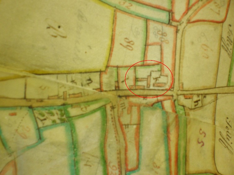
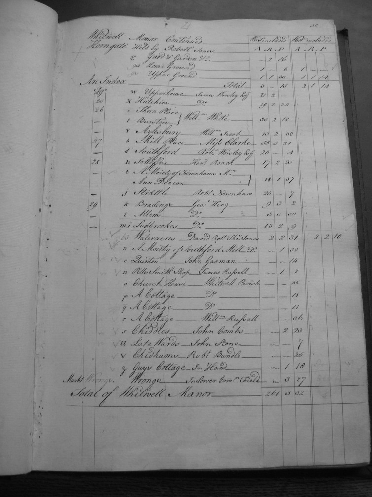
Turning to maps of Whitwell, the earliest map that shows the property of Strathwell Dale, as it was known then as Bradings is the 1773 Worsley estate map; this is accompanied by the survey book giving details of the property and its lands. (See Fig.1) The Worsley’s of Appledurcombe owned the land on which Bradings was built. The tenant is a George King, who is also leasing Allens, and Ludbrookes. (Worsley, 1773)

Fig 1
The properties labelled k can be identified as being Bradings, with l being Allens and m being part of Ludbrookes. (See Fig. 2)

Fig 2